

GENI/Geography CA 323A
425 University Blvd.
Indianapolis IN 46202-5140
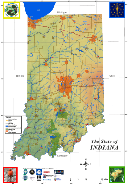
THANKS to an ATLAS Grant from the Indiana Geographic Information Office, GENI will deploy 20Giant Maps of Indiana around the state to organizations/collaboratives demonstrating the ability and vision to teach and learn Geography and Geospatial Technologies. The Map will be a permanent resource for your organization to aid in the teaching and learning of 21st Geography and Geospatial Technologies! The GMIN measures 10’ east/west x 16’ north/south and is printed on light-weight vinyl, folds into a manageable size and contains LOTS of information about the state.
Applicants MUST be willing to:
- Participate in a Giant Map of Indiana Professional Development Training (required) and occasional virtual support as needed.
- Engage Educators, Students & the Community in the teaching & learning of Geography utilizing the Giant Map of Indiana (guidance and support provided)
- Employ the Giant Map of Indiana (at least) monthly in a teaching & learning environment
- Complete an Evaluation after each Giant Map of Indiana teaching & learning session
Schools, school corporations, libraries, museums, after-school programs, parks, 4-H, FFA, Scouts… rural, suburban, urban. All are welcome to apply! The goal is to USE THE MAP, not to have it sitting around gathering dust!!!
Apply: Download and complete the application and e-mail to geni@iu.edu or postal mail to the address below. DEADLINE: September 3, 2026